

Jammu & Kashmir, Himachal to Receive Heavy Showers; Delhi Set for Overcast Weather: IMD
Delhi sweltered under intense heat on Thursday as temperatures soared past the 40-degree Celsius mark, with the maximum temperature settling at 40.6°C—nearly 3.8 degrees above the normal seasonal average—making it one of the hottest days in recent weeks. The warmth extended through the day, with the minimum temperature also unusually high at 25.7°C, about 4.1 degrees above the average for this time of year. According to the India Meteorological Department (IMD), the national capital is expected to see a slight respite from the scorching conditions over the next few days, though high temperatures will persist. For Friday, the IMD has forecast a partly cloudy sky accompanied by strong surface winds with gusts reaching up to 40 kmph. While no significant rainfall is expected in Delhi on Friday, the maximum temperature may hover between 38 to 40 degrees Celsius, and the minimum is likely to remain in the range of 24 to 26 degrees Celsius. The weather is predicted to be warm but not extreme, as the IMD has ruled out the likelihood of a heatwave in Delhi and surrounding areas at least until Wednesday, April 23, which is expected to offer some comfort to residents bracing for the peak of summer.
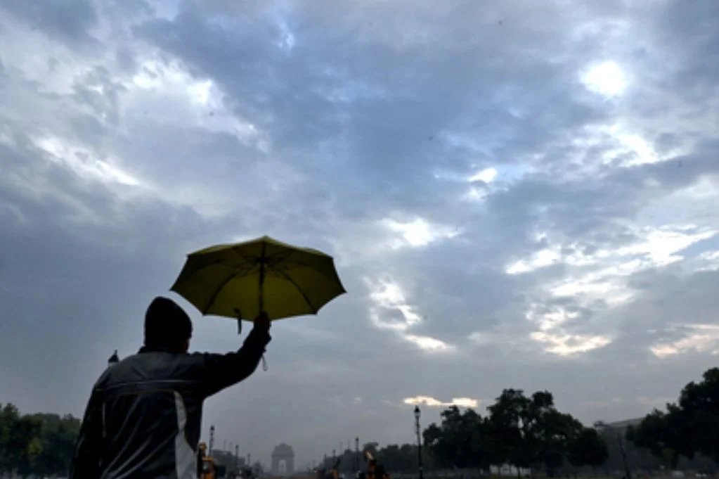
Saturday could bring a shift in weather patterns as the capital is expected to experience very light rain, with strong surface winds potentially gusting up to 50 kmph. The sky will remain mostly cloudy throughout the day, lending temporary relief from direct sunlight, though the temperatures are not expected to dip significantly. The cloudy weather will likely extend into Sunday, although there is no forecast for rain on that day. The cloud cover could keep temperatures somewhat in check and may help reduce daytime heat exposure. Starting Monday, however, Delhi’s sky is projected to clear up, returning to typical early summer conditions with bright sunshine and warm air. Residents are advised to stay hydrated, limit outdoor activities during peak hours, and keep an eye on local forecasts for sudden changes in wind or temperature.
While Delhi escapes severe weather for the time being, several other parts of the country are facing more intense meteorological activity. In the hilly terrains of Jammu and Kashmir, Ladakh, and Himachal Pradesh, the IMD has issued warnings for heavy rainfall, snowfall, and even isolated hailstorms on Friday. These conditions are part of a larger western disturbance moving across the northern belt of India, bringing with it a mix of rain and snow that could disrupt normal life, especially in higher-altitude regions. The precipitation could provide some short-term relief from the dry spell but may also cause roadblocks and landslides in sensitive areas. Tourists and residents in these states have been advised to exercise caution, especially if traveling through mountainous roads.
In the northeastern part of India, heavy rainfall is also on the radar, particularly in Gangetic West Bengal, Assam, Meghalaya, Nagaland, Manipur, Mizoram, and Tripura. These states are expected to be hit with significant precipitation due to a combination of moisture-laden easterly winds and local weather systems. The downpour in these areas could lead to localized flooding, waterlogging, and disruption in road and rail transport. Residents are urged to monitor alerts and avoid low-lying or flood-prone regions. These pre-monsoon showers, though common during this season, can be erratic and severe, often catching people off guard due to their sudden onset and intensity.
Elsewhere, scattered parts of Bihar, Haryana, and Karnataka are likely to experience thundersqualls accompanied by lightning and wind speeds reaching up to 70 kmph. These rapidly developing storm systems can be dangerous, with the potential to damage structures, uproot trees, and disrupt power lines. People in affected areas should take cover during thunderstorms and avoid open spaces. Furthermore, isolated pockets across Uttar Pradesh, Jharkhand, Odisha, Assam, Meghalaya, Nagaland, Manipur, Mizoram, Tripura, south interior Karnataka, and Kerala are also under the threat of lightning strikes and gusty winds, potentially hitting speeds of 60 kmph. These regions, already accustomed to volatile summer weather, are nonetheless being asked to remain on alert due to the unpredictable nature of the upcoming storm patterns.
Even in relatively calmer zones, including parts of Uttarakhand, Punjab, Chhattisgarh, sub-Himalayan West Bengal, Sikkim, and Telangana, milder versions of these weather events may persist. These areas might experience overcast conditions, light rain, and sporadic thunder or gusts of wind, which, while not severe, could still impact day-to-day activities, especially agriculture and outdoor labor. The IMD’s alerts are aimed at ensuring preparedness and minimizing disruption, especially in rural and semi-urban regions where infrastructure may not be resilient to erratic weather changes.
Overall, while Delhi bakes under the early summer sun with brief patches of cloudy skies and mild relief in the form of surface winds or light rain, the broader Indian subcontinent is witnessing a spectrum of weather conditions. From snow-capped peaks in the north facing fresh snowfall to the rain-drenched northeast, and southern states dealing with thunder and gusty winds, the varied weather reflects the complexity of India’s climate systems during the transition from spring to summer. The IMD continues to monitor these developments closely, and citizens are encouraged to stay informed through official updates and take appropriate precautions in their respective regions. With April nearing its end, the weather across the country is expected to remain dynamic, with heatwaves, rainfall, and stormy conditions all in the mix as India slowly moves toward the full onset of the monsoon season in the coming months.


